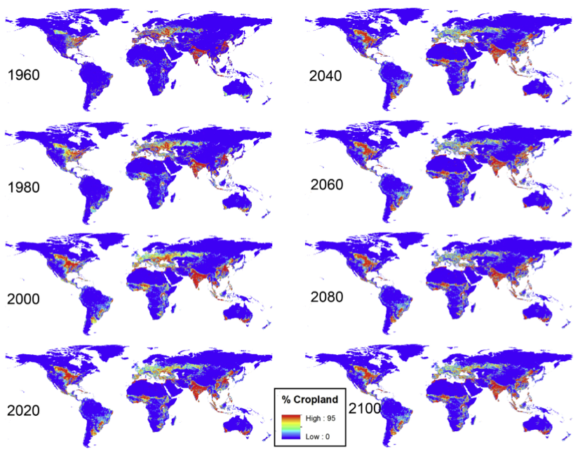
The Global Land Use Dynamics Model (GLUDM) is a gridded and temporally explicit agricultural land use predictor. GLUDM calculates the relative area of a land use category (e.g. cropland) in each grid-cell by generating unique regression coefficients in each grid-cell based on local historic trends and global population dynamics. Spatial ex- pansions or abandonment of agricultural land is simulated by propagating excesses or deficiencies in agricultural areas between neighboring grid-cells. This spatial connectivity is restricted by topographic, latitudinal and urban characteristics. A validation analysis shows that GLUDM corresponds well to observed land use distribution.
- Model description and download (via CSDMS Model Repository)
- Model output download
Papers
- Haney, N., Cohen, S. (2015), Predicting 21st century global agricultural land use with a spatially and temporally explicit regression-based model. Applied Geography, 62: 366-376. doi:10.1016/j.apgeog.2015.05.010 [pdf]