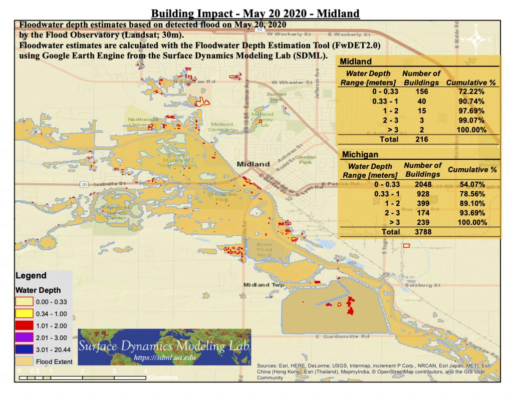
Floodwater Extent, Depth and Impacted Buildings
Flooding extent was mapped using a Landsat Satellite Image from May 20, 2020 (by the Flood Observatory).
Water depth calculated using the Google Earth Engine Implementation (by Dr. Brad Peter) of the Floodwater Depth Estimation Tool (FwDET).
Impacted buildings were classified using the Microsoft Building Footprint Dataset.
GIS data (shapefile and GeoTif) and figures are available here.